Great Smokies Revisited
Revisiting the Smoky Mountains during some time off, I explored the Deep Creek Loop Trail, which sports the Toms Branch Falls and the Indian Creek Falls.
I opted to return to the Great Smoky Mountains for this hike, since I had some time for a mid-week trip. It’s a bit farther than I normally go, since it’s a few hours to the park, but when my wife and I had done some hiking in the Smokies during our vacation, I developed an interest in exploring the park further. Thus, I decided to try the Deep Creek Loop Trail.
The Deep Creek Loop Trail is just over 4.5 miles round-trip, and the two main features are Toms Branch Falls and Indian Creek Falls. The trailhead can be found just outside of Bryson City, North Carolina. The entrance can be a little tricky to find, as it seems to go through a residential area, but Google maps has the right directions, so even if it looks odd, give it some time, it works out. Once you’re in the park, it is a largish recreational area, with picnic tables near the creek and well-kept facilities. The trailhead is at the end of the road, where there was ample parking, particularly as it was during the week.
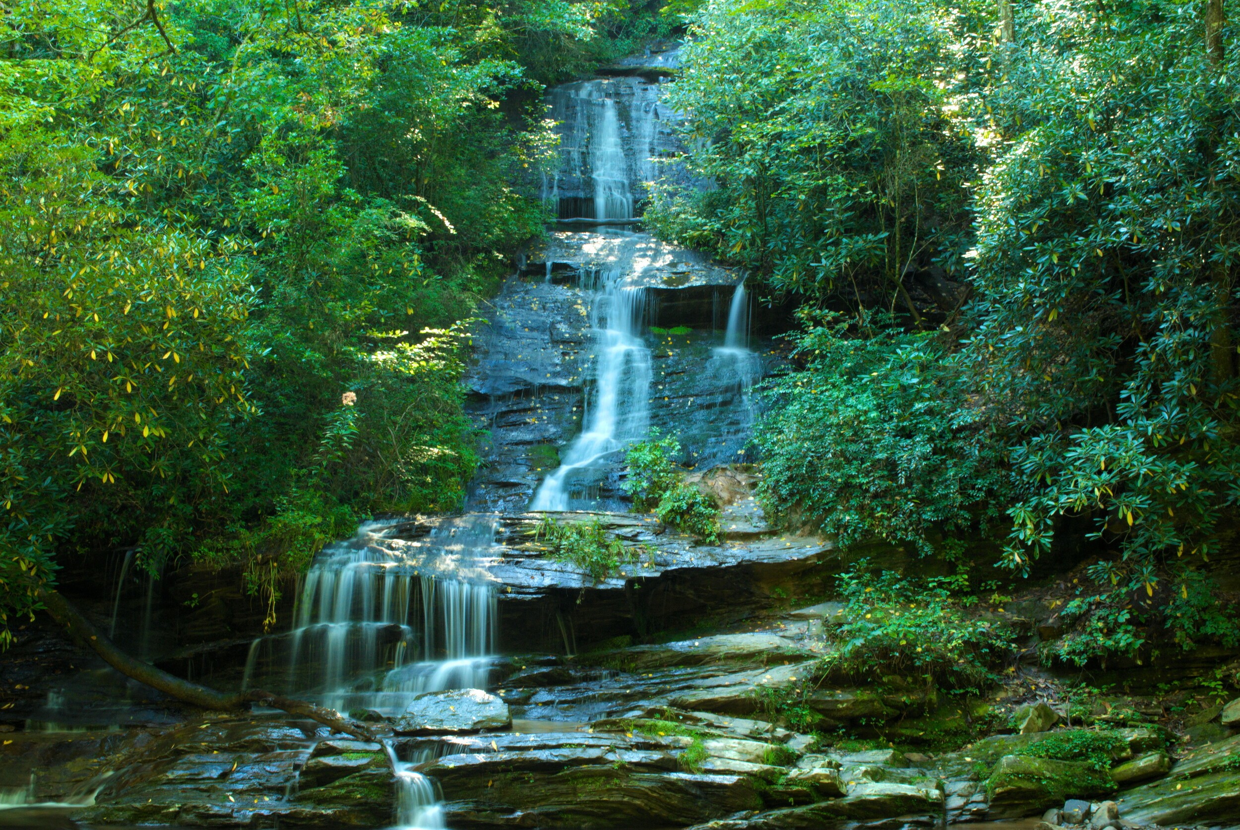
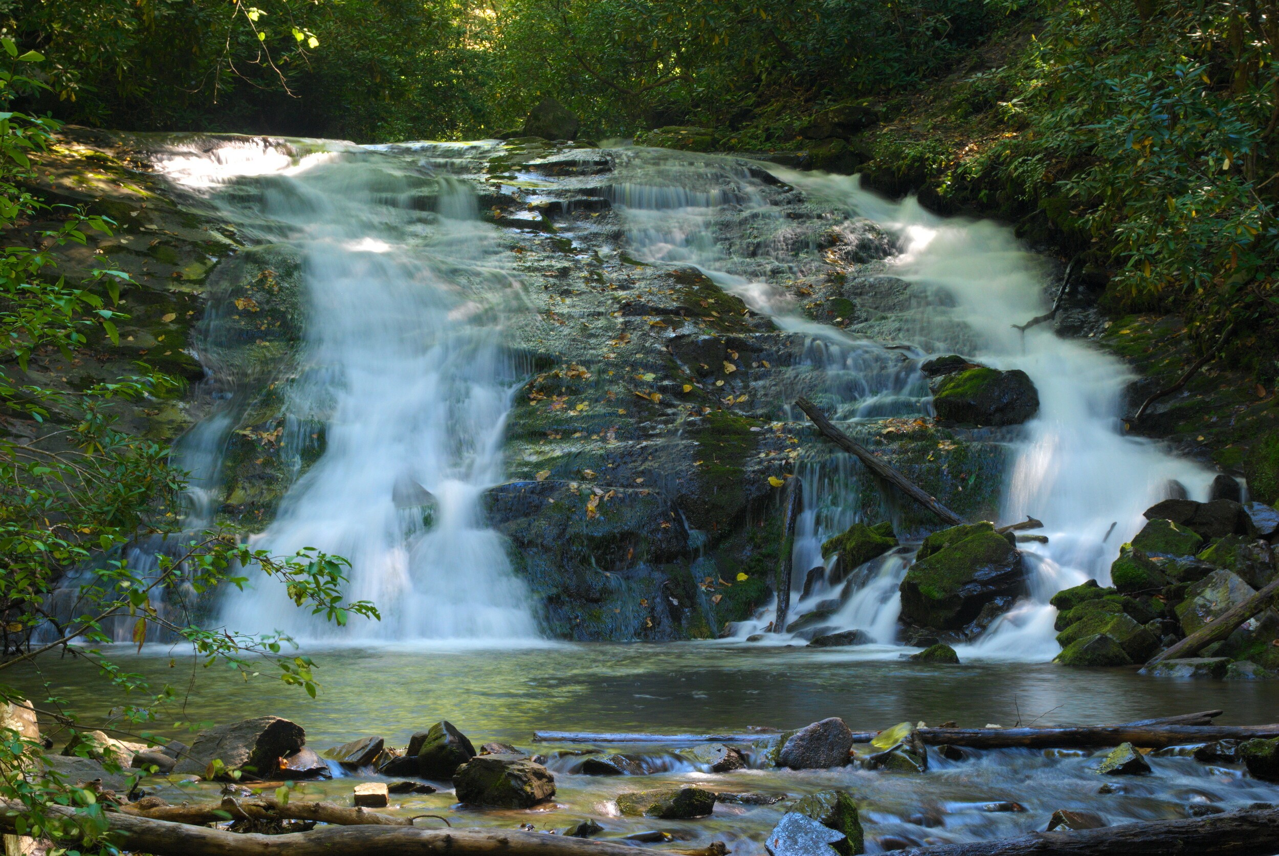
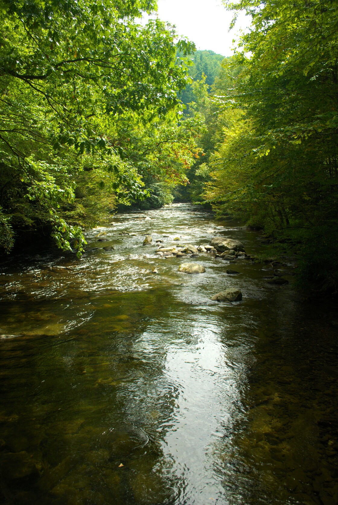
The trailhead is very well marked, so I just grabbed my gear and headed off. The first stage of the trail follows Deep Creek pretty closely, and there were folks fishing in the stream. Along the way, there are many benches for resting or just watching the water go by. Not far from the trailhead, just under half a mile, Toms Branch Falls can be seen from the trail.
The falls are obviously a popular spot to sit and watch, as evidenced by the many benches surrounding what looked like a small beach, facing the waterfall. I got a few shots of the waterfall, which was pretty, if not spectacular. It’s about 80 feet tall, and spills down over multiple levels.
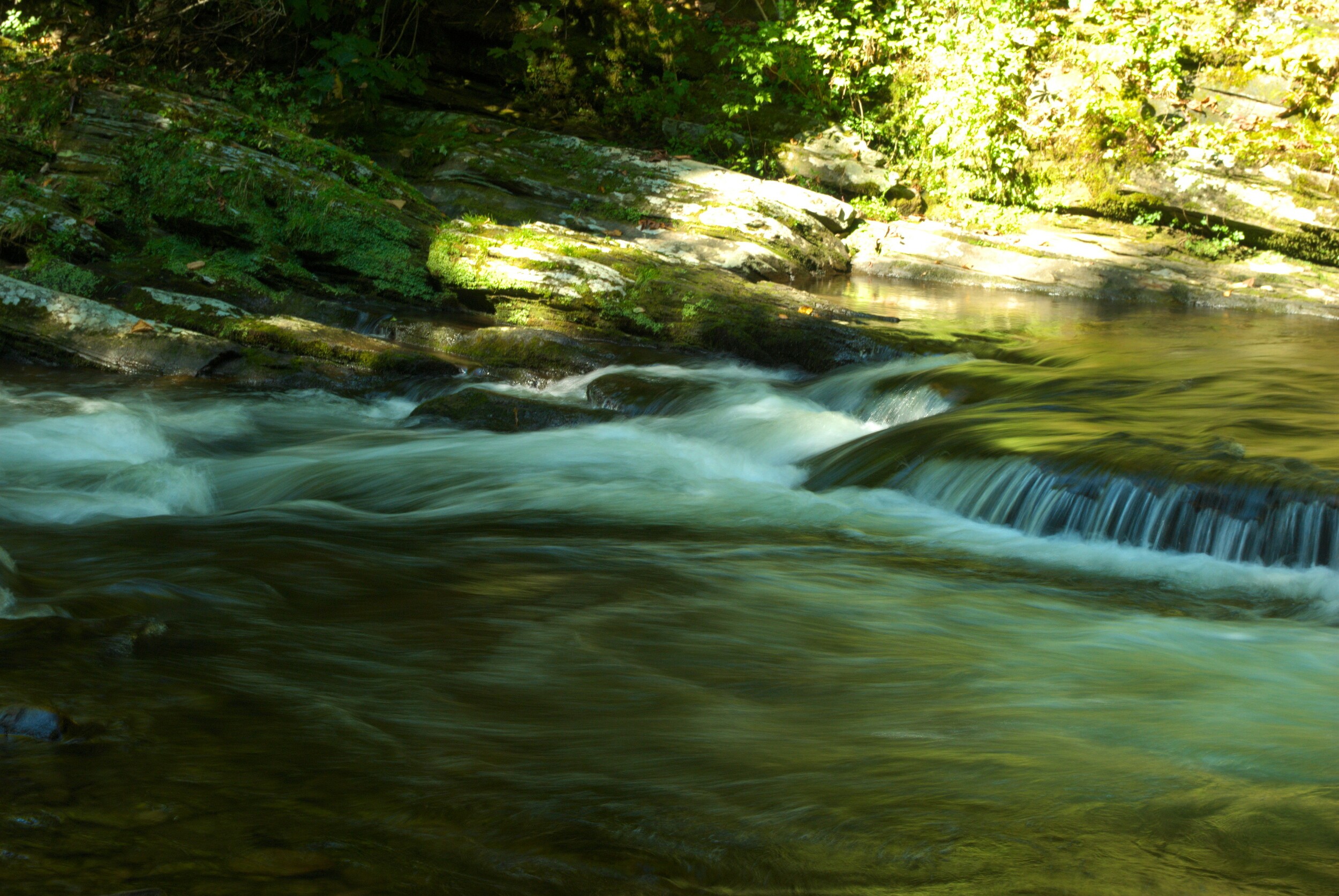
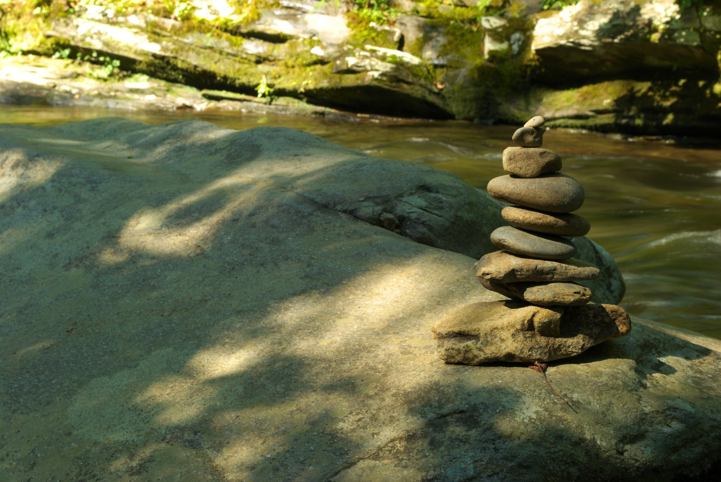
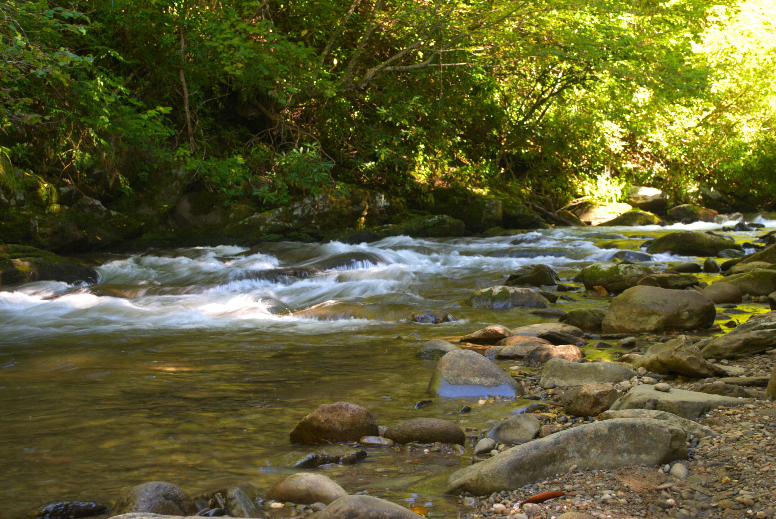
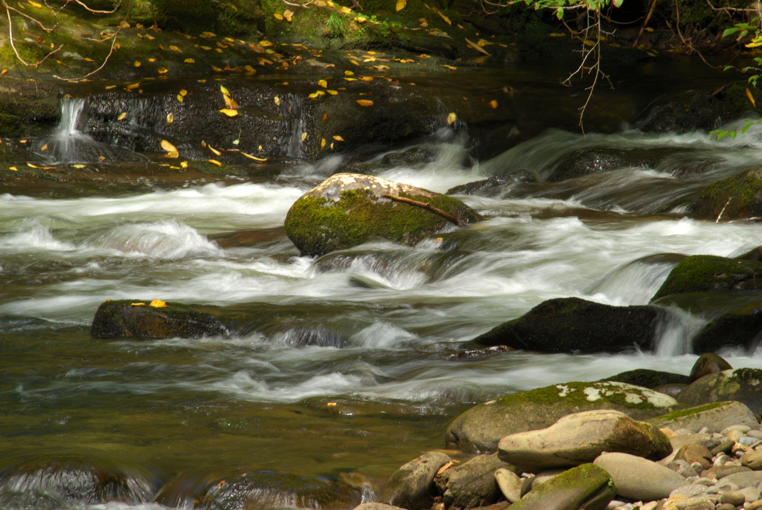
Just down from Toms Branch Falls, a bridge crosses Deep Creek. There were good views of rapids just on the other side of the bridge, and I sat with the tripod out on one of the flat rocks that jutted out into the creek. Besides the rushing water, someone had stacked some smooth, round flat stones into a kind of cairn, which provided some interest for picture-taking. I probably spent more time there than I did at Toms Branch Falls.
But, eventually, I gathered my equipment and headed on to Indian Creek Falls. Less than a mile from the trailhead, the trail forks off, where Indian Creek splits off from Deep Creek. I turned right to follow Indian Creek to a relatively steep spur trail down to Indian Creek Falls. The way down is assisted by steps, so it isn’t all that precarious.
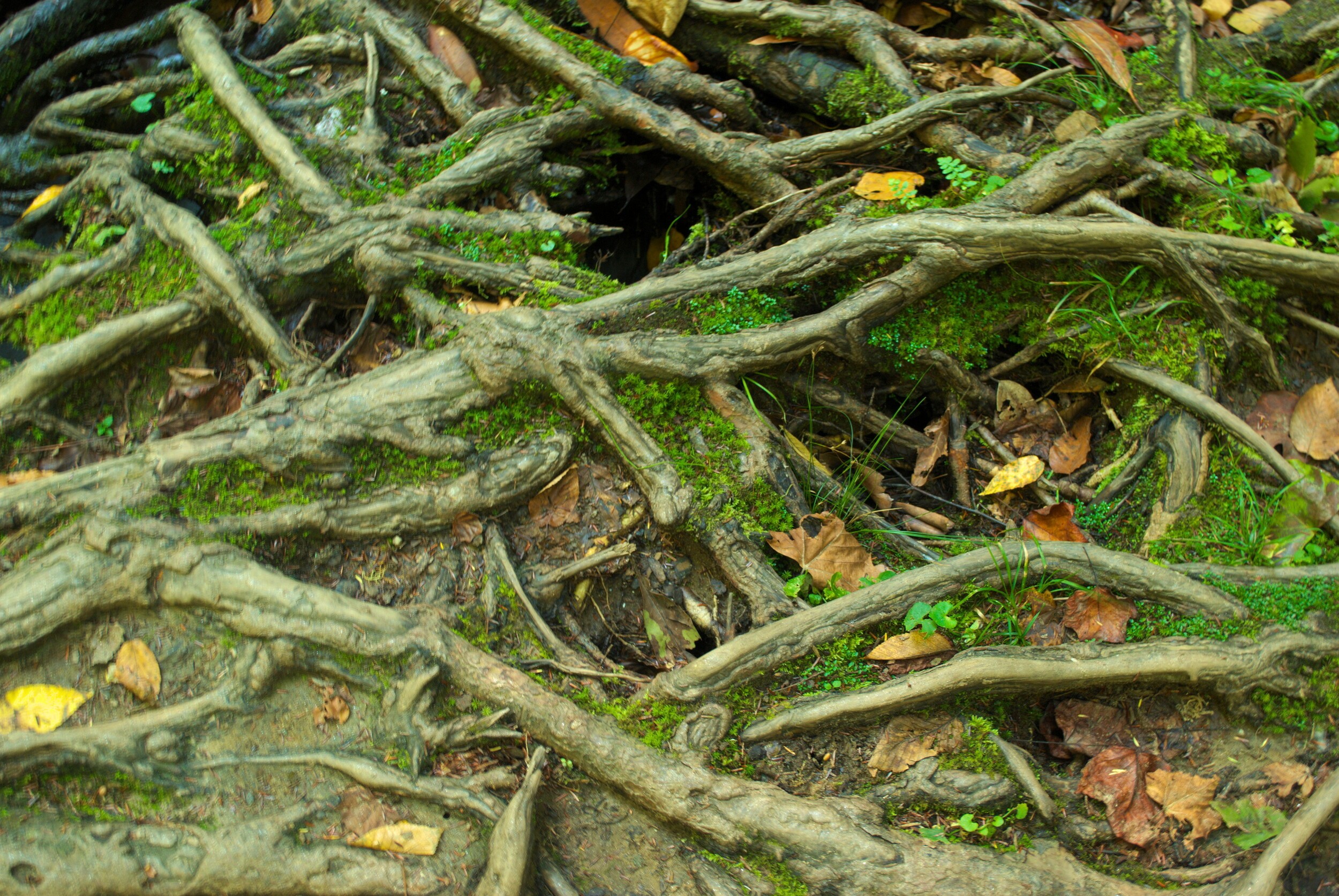
Once down there, I found it difficult to find a good spot to see the falls, which is more like a sluice than a fall. It’s very pretty, but between the sun’s position, and trying to find good footing for the tripod among the intricate roots, I didn’t get too many good shots of the waterfall. But, I was also able to get some pictures of those roots, which were fascinating in and of themselves. If you’re not working to get pictures, it’s a serene little spot to hang.
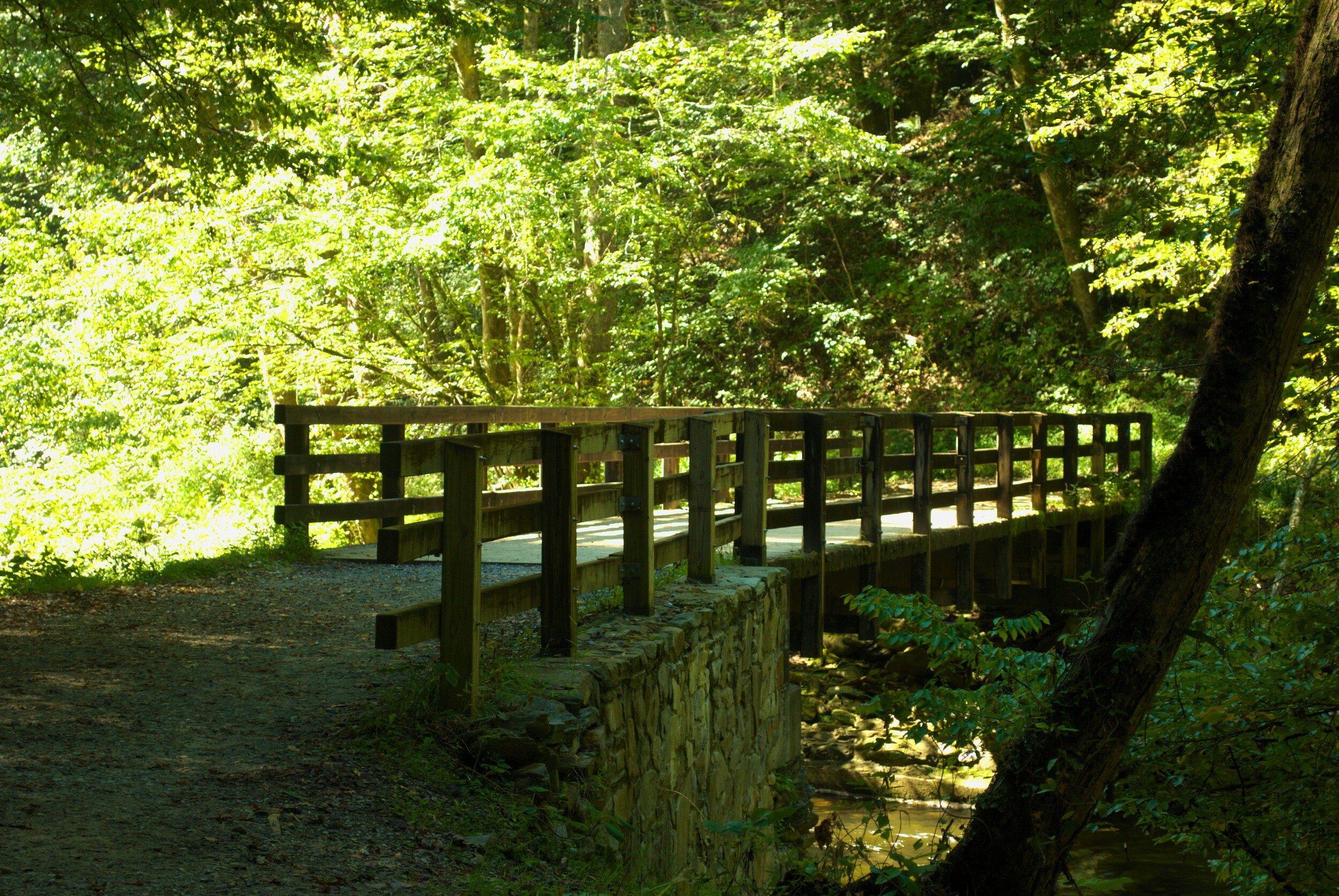
After I got back up to the main trail, I followed it to where it crosses Indian Creek by way of a footbridge. You can kind of see Indian Creek Falls from the top, as it crosses under the bridge. And then the trail continues on along Indian Creek.
Just over 1.5 miles from the trailhead, I came to a junction where the loop trail breaks off to the left, while Indian Creek Trail continues on. This trail is significantly more rugged and travels through thick rhododendron as it climbs to Sunkota Ridge. The elevation change here alters this trail from relatively easy, to more than somewhat moderate. Over a period of about a half-mile, the elevation increases by about 300 feet.
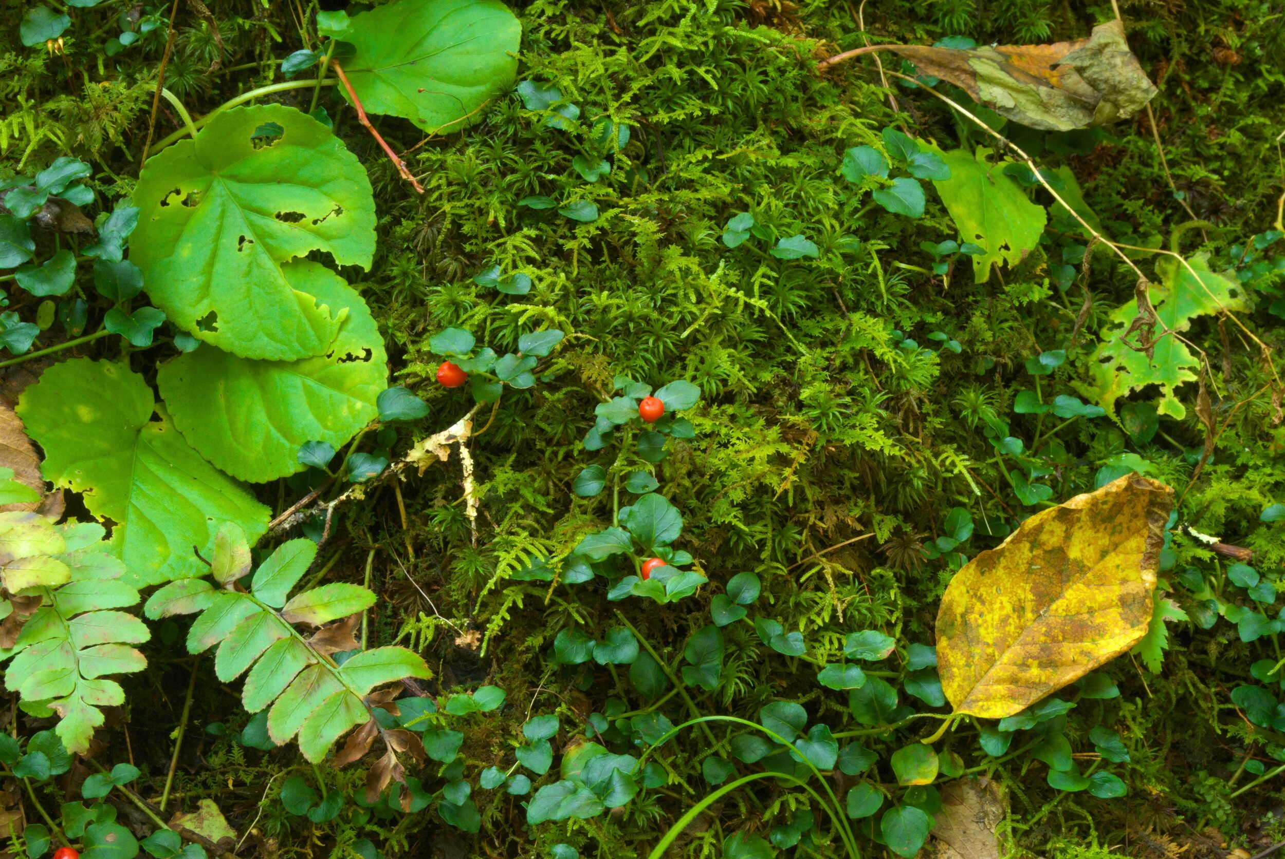
At Sunkota Ridge, the loop trail crosses the Sunkota Ridge Trail, and then heads back down. I stopped on the way down to take some pictures of the ground cover. I had hoped this was “Hearts ‘a Bustin’ with Love,” a wildflower that was supposed to be all around this hike, according to one guide. However, it was something else that I wasn’t able to identify. It seems that the flower in question wasn’t blooming at this time of year. I am glad I looked it up, however, as it helped me to identify one of my other pictures, which is Heart’s-a-Bustin-with-Love (see the last image in Hidden Away). Now I know.
As I reached to where the trail leveled out, it joined back up to the Deep Creek Trail. Not far from there, I stopped on a bridge across Deep Creek, for some great pictures of the rapids in the creek. I also avoided some bicyclists out enjoying the day, trying to keep my tripod legs from causing an incident.
On the way back to the trailhead, I had a nice conversation with a fisherman, who was heading up Deep Creek in the opposite direction. We compared notes on the different directions of the trail, and then went our separate ways. I also met a couple taking pictures of Toms Branch Falls on my way back. One of them had a very cool monopod/tripod combo that I’m still hoping to look for to try out.