Strange Weather Patterns
A winter hike in odd weather led me to Raven Cliff Falls in Caesar’s Head State Park in the Mountain Bridge Wilderness area of South Carolina.
So, in mid-January, I headed over to Caesar’s Head State Park, to do some more hiking in the Mountain Bridge Wilderness Area, north of Greenville, SC. This is the same area as the Frank Coggins Trail, which I have done a few times. On this occasion, I decided upon the Raven Cliff Falls Trail, a moderate 2.2-mile trail.
Now, the name of this trail is one that I find interesting, because I’m used to the Raven Cliff Falls Trail in north Georgia. In fact, I went on the Raven Cliff Falls Trail in Georgia last year, but because I completely forgot my camera equipment, I didn’t get any photos. But, apparently, this is a popular name around my area. I did a quick Google search, trying to find the source of the name of the waterfall in South Carolina, but to no avail. So, I remain mystified as to why this name was used multiple times in a relatively small area.
So, the trail head for Raven Cliff Falls is just a little ways beyond the visitor center parking. I had stopped at the visitor center, as I always do, to pay my fees, and there was a smattering of rain. When I got back to my car to head off to the trail head, the rain would increase in fits and starts, never lasting but a minute or two, but it was there. I debated the wisdom of continuing on, checking the weather reports, but decided I was going to go anyway. My camera is protected in a waterproof case, and I’ve got my poncho, if necessary. I didn’t want to miss my weekly adventure.
As I approached the trail head, the main parking area was already full, with people getting their gear, ready to set off. This was my first inkling that this was a popular trail. I drove on a bit, trying to figure out if I was going to have to park at the visitor center and hike up the road to the trail head. This is a winding, curving road, and the thought of walking along this road, avoiding the drivers that speed down these roads at a higher velocity than is strictly safe, was not comforting.
Luckily, there was another area with cars parked just ahead. I saw a sign saying “Overflow Parking for Raven Cliffs”. Yes, this is a popular spot. I parked in a space near the other four or five cars already parked there. By this time, the rain was in its “off” position again, so I got out, got my gear settled, with my poncho in easy reach, and headed off to the trail. So, I *did* end up hiking along the road, but only for a few hundred feet, and there was plenty of shoulder.
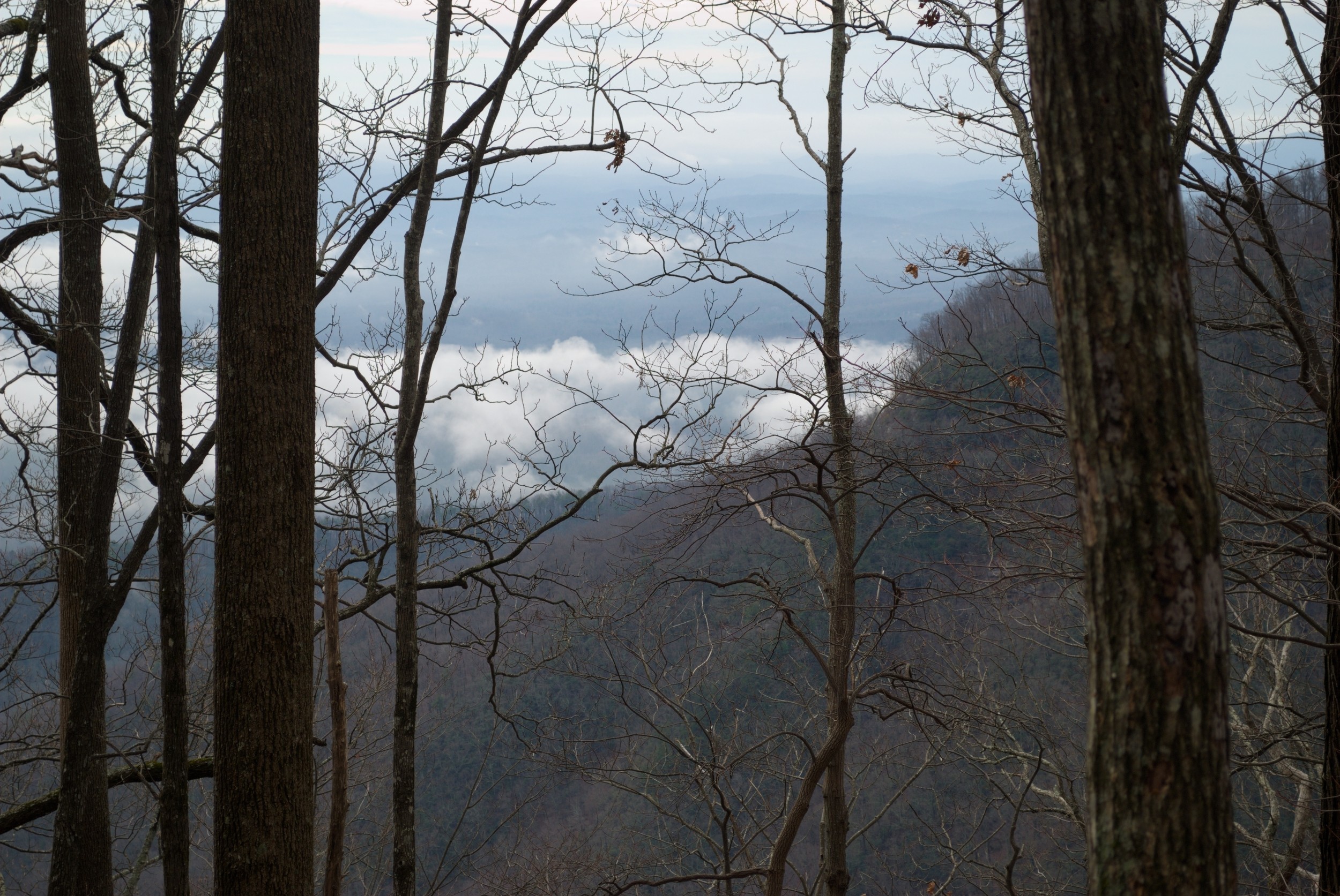
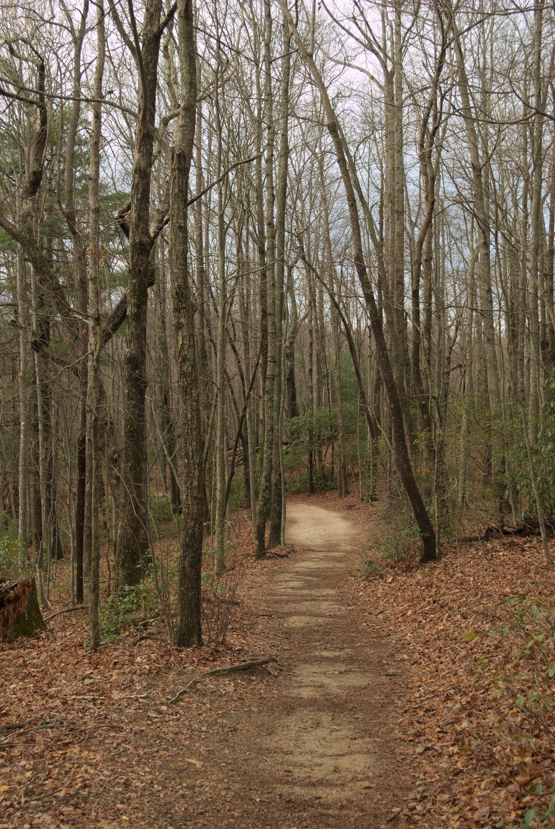
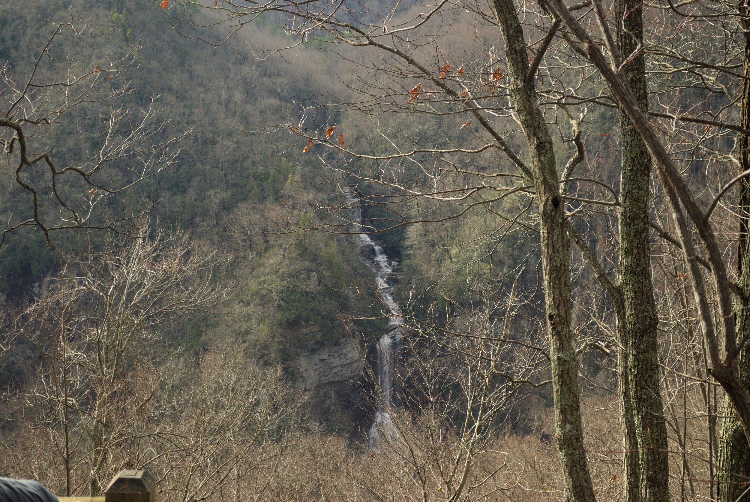
The trail begins on what looks like a gravel maintenance road, but quickly turns into a more traditional dirt trail. The weather at this point was cool, and the skies were still quite grey, but no rain fell. Through the trees to my left, I could catch glimpses of the view across the valley, with the clouds drifting around the tops of the foothills. I never got a clear enough spot to take a photo that really did the view justice, but I have included one that hopefully gives an idea. In the spring and summer, I doubt one would be able to see much of this, at all.
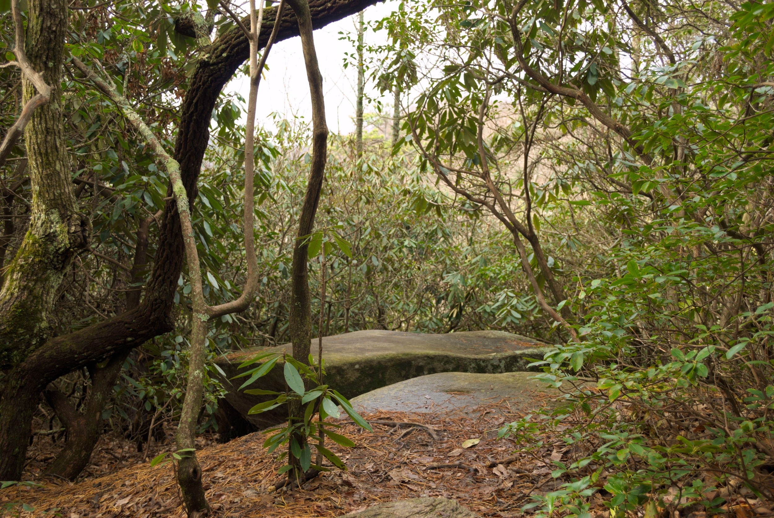
The trail wound back and forth, following the line of the ridge, and at one point, there was a large flat boulder just off the trail that offered what seemed to be a nice platform for viewing the valley, but the tops of the trees were just too tall to get a good panorama. Still beautiful, though. Just beyond this, there was a wooden staircase to navigate a quick elevation drop before continuing on its winding way.
As the trail continued, the temperature began to rise, and not just because I’d been hiking. The sun was breaking through the clouds. Along with other hikers I met along the way, I removed some layers. As I neared the final stretch to the falls, I realized I was hiking in the middle of January in T-shirt and jeans. And I was almost wishing I had worn shorts. Very unusual for January, indeed.
I reached the viewing platform for the falls with the sun pretty much fully out, with a good amount of blue visible through the thin clouds. And, then I really saw the popularity of the spot. The viewing platform had one covered level, with benches, and a lower open platform closer to the falls. Both levels, and the staircase connecting them, were filled with people. Everyone was taking advantage of the warmer weather to enjoy the outdoors.
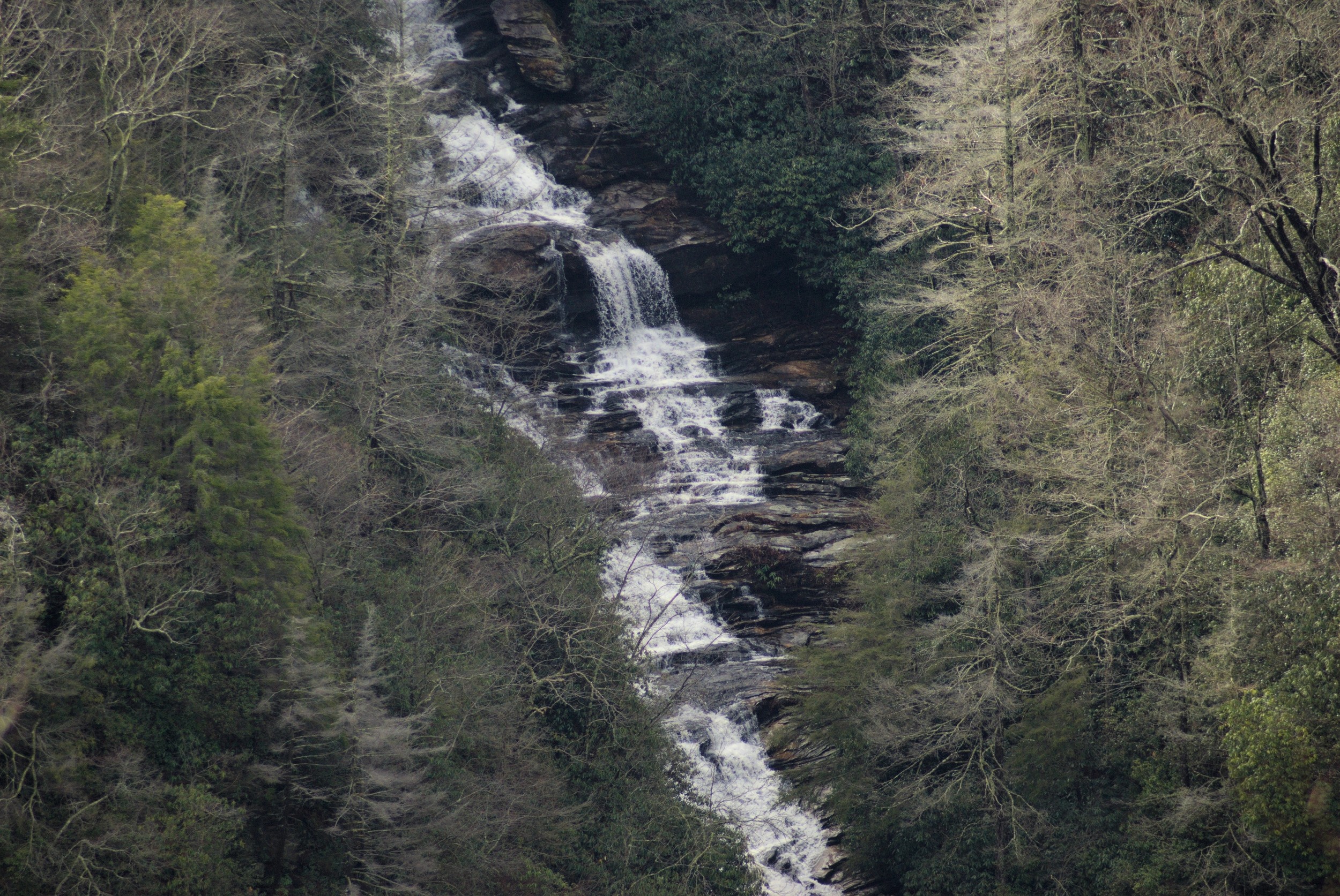
I found a spot on one of the benches in the covered level to get a view, and started taking some pictures. I was somewhat disappointed at the distance to the falls. I had expected a much closer vantage point. Instead, the falls were across a valley. This made it easy to see the impressive distance of the fall from the top to the bottom, but I couldn’t get a very close image, without the telephoto. I only had my monopod, however, not my tripod, so getting a steady telephoto image was not easy. I chose one to show below, and it was one of the only ones worth keeping. I *did* eventually get to the lower open level. Most of the mass of humans were part of a large hiking group, and it thinned out considerably when they left.
Raven Cliff Falls itself is pretty impressive, and reminded me of the Lower Whitewater Falls, which had a similar configuration. There is another trail, called the Dismal Trail, that leads to a closer look at the falls, over a suspension bridge, but it is a much more difficult hike (and would add another 3 or 4 miles to the hike), so I felt it was better to save it for another day.
The hike back was rather uneventful, but the weather turned again, as I neared the staircase, and it got cooler, the sun slipping back behind clouds that were thickening again. By the time I was on the last leg back, I had put my flannel shirt back on and I found myself checking that my poncho was still at the ready. I got back to the parking lot, which was now full to the brim with vehicles, put my gear in the car and got into the driver’s seat, just as the rain started up again. Very strange weather, indeed, but it seemed to have worked to my advantage.