Third Try at Parson’s Mountain
I made it to Parson’s Mountain on my third try for this loop just outside of Abbeville, South Carolina, and enjoyed the 4-mile hike in late spring.
The Parson’s Mountain Recreation Area is just outside of Abbeville, SC, which is about an hour and a half south of the Clemson area. I got to be rather familiar with this route, as I had tried multiple times to take this trail. I had been looking for a different place to hike, and I had found the loop trail around the lake at Parson’s Mountain on the internet. During the late winter months, I drove down to the park, ready to take this 4-mile loop, only to be stymied by the closed gate there at the entrance to the area. I looked up the recreation area on its website, and it revealed that the park was closed during the winter, but opened in April.
In April, I drove down again, ready again to give this trail a shot. When I saw the closed gate again, I was more than a little put out. I looked up the area, this time on the US Forest Service website. On this site, it said that it would be open in May. On the one hand, I’m annoyed that the maintainer of the Parson’s Mountain website wasn’t keeping the information current, but on the other hand, I should have checked multiple sources before driving all the way down, especially the second time.
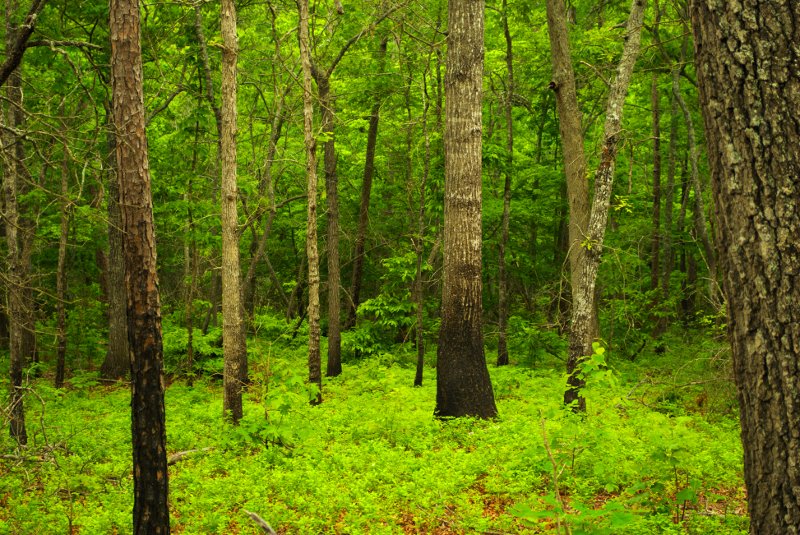
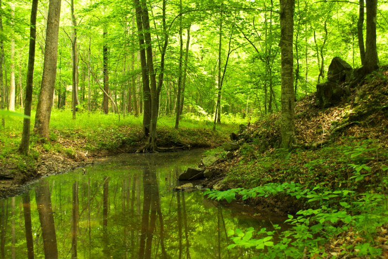
But, the third time proved to be the proverbial charm, and I was able to try this trail in early May. It is a pretty trail, and not particularly difficult, and the spring was much more fully in play than in previous hikes. Over the winter, I had been used to seeing starkly beautiful views of evergreens against hibernating deciduous trees, but now, the color was green. And it was very green. The trail wanders around the lake, over creeks with small cascades, every now and again providing a view of the lake.
One of the first things I noted about the trail is that I should have taken a photo of the map at the beginning of the trail. Although for the most part, the trail was relatively well-blazed, there were some places where it was difficult to know where to go. There is a spur trail that goes up to the fire tower at the top of Parson’s Mountain, which as other sources reveal is a type of hill called a monadnock, which rises abruptly from a gently sloping surrounding area. I wanted to take this spur, because the increase in slope it would provide a more difficult experience than the general loop trail. And it was fortunate that I wanted to, because there wasn’t really a good sign that tells you where this spur is. If you want to stay on the loop trail, follow the sign that says “Swimming Area,” because that leads you on around the trail. If you stay on what looks like the regular trail, that’s actually the spur.
The spur leads you across the road that circumnavigates the trail, and you are then met by what I’ve decided is just about the most ambiguous sign I’ve seen, yet. There are two trails, one that heads off to the left at an angle, and one that heads off to the right at an angle. And the sign points straight ahead between them. I flipped a mental coin and headed off to the left. In the end, either would have gotten me where I wanted to go, which was past a series of pits that are all that’s left of a Civil-War era gold mine. I stopped to look around the mines, which are surrounded by chainlink fences to keep people from disturbing them further. To get pictures, I basically had to hang the camera over the top of the fence and shoot blindly.
Once you pass the mines, the trail gets steeper and rockier, and climbs to the fire tower. I didn’t spend much time there, just greeted a group of younger hikers hanging around, and then headed back down. I was hoping to find where the spur was, and I was hoping it was the “Swimming Area” sign. And it looked like it was threatening to rain, so I didn’t wish to dally.
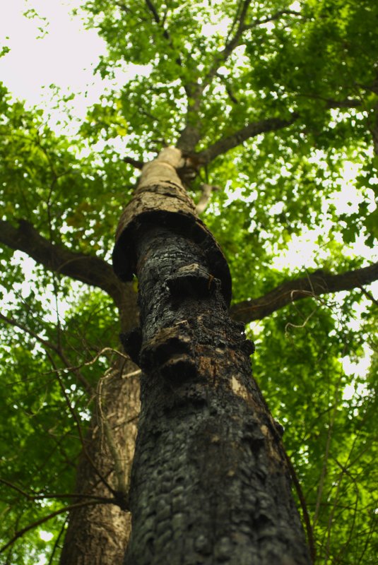
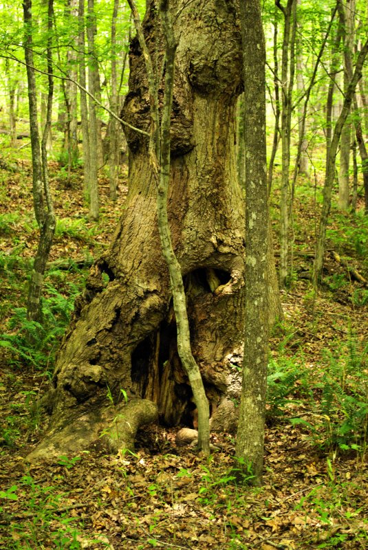
I stayed ahead of the younger group, who headed down the mountain not long after I left. However, after stopping to take more shots, they passed me and ended up being in front of me for the rest of the hike. The second stop for a picture was a little more exciting than I had intended, as I moved off the trail to get a picture of a great old gnarled tree. As I moved forward, I narrowly missed treading upon a black snake with yellow bands, probably a common kingsnake. Although it probably wasn’t very dangerous, I decided not to impose myself into its personal space, but just took pictures of the tree from more of a distance. I even got a couple of shots of the snake, just for good measure.
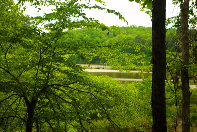
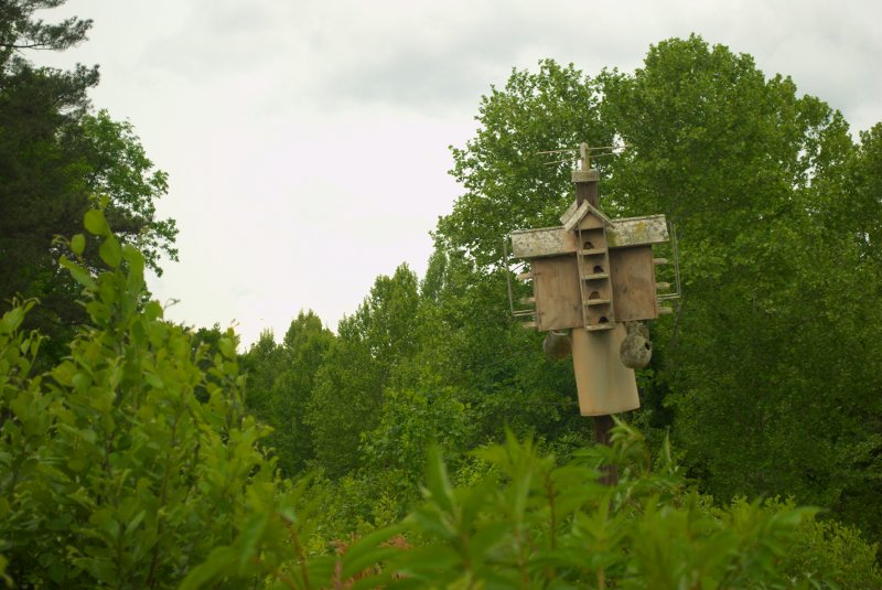
The trail eventually got very close to the edge of the lake and then got difficult to follow. I followed the trail out along a spit of land over a bridge, and was treated to a nice view of the lake, and an intricate birdhouse, but the trail seemed to close over at that point, so I went back. My erstwhile hiking partners apparently took one trail that led around the edge of the lake, but I had located the white blazes and decided to follow them away from the lake and over another creek back to the swimming area, which was where I had left the car.
I enjoyed the hike, and would recommend it if you’re in the area, or just want a nice quiet place to hike, swim, camp, or just hang out by the lake.