Sometimes it Pays to Bring a Map
I kind of got lost, had trouble finding one of the landmarks for this hike, so I ended up going on a much longer trip than I had expected along the Blue Ridge Railroad Historical Trail.
In late May, I took what turned out to be a 7 or 8 mile hike in upstate South Carolina, just north of Walhalla. The Blue Ridge Railroad Historical Trail is a 2.5-mile in-and-out trail that begins at Stumphouse Tunnel Park and follows an incomplete railbed for the Blue Ridge Railroad. This railroad was begun in 1852, with the intent of connecting Knoxville, TN with Charleston, SC. The railroad itself was to involve a line to be built from Anderson, SC to Knoxville, through 13 tunnels that were to be dug as part of the project. By 1859, the only part of the line to be put into operation was that between Anderson, SC and Walhalla, SC. After that, lack of funding and the Civil War stopped the continuation of the line. The trail shows the location of two tunnels, the Middle Tunnel and the Saddle Tunnel, that were part of the construction.
Now, the mathematically-inclined might note that a 2.5-mile in-and-out trail should only be a 5 mile hike, not one between 7 and 8 miles. You are correct, but I maintain that I did, indeed take a 7 or 8 mile hike. The rest of this post will explain.
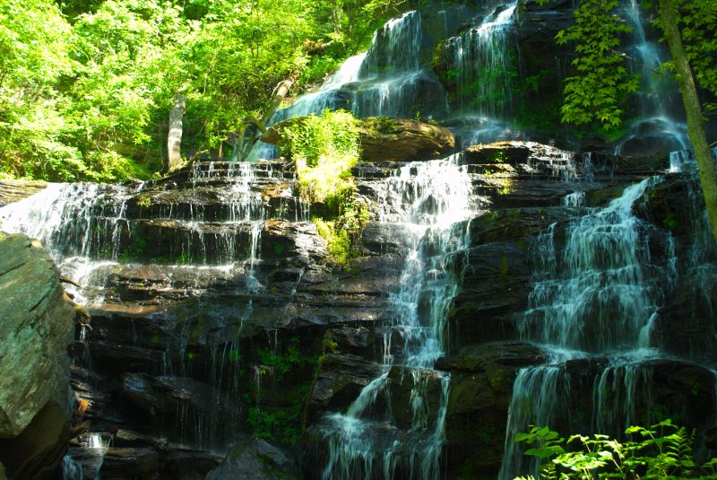
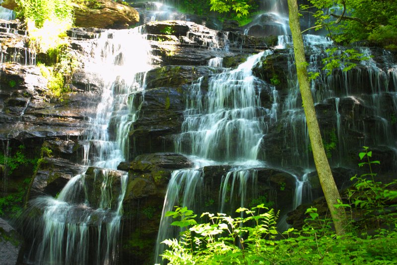
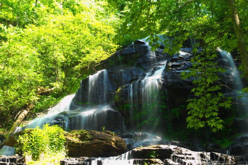
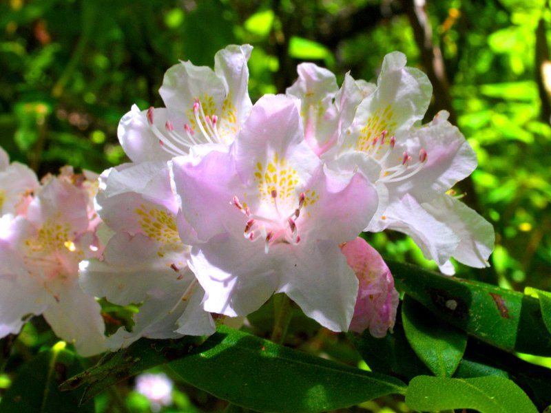
One of the other sights to see at Stumphouse Tunnel Park is Issaquena Falls, a lovely tiered waterfall reminiscent of the Yellow Branch Falls, which are not far from this location. I decided to get a few shots of this popular waterfall while I was there. There is an outlook for the falls just beyond the parking lot (200-300 feet), and that was fine, but there is also a trail from the outlook that takes one down to the base of the falls. I decided to keep on going to the base of the falls, which is not very far at all, but a bit steep. I stayed there for a little while, trying out some different angles and exposures.
I didn’t stay too long, however, as I still had the main event to do, and I had hoped not to be out the entire day. So, I tried to find the entrance to the trailhead for the Blue Ridge Railroad Historical Trail. It’s not very well marked, but I finally located it. Once I found it, it was quite well blazed, and I got used to following the yellow blazes to make sure I stayed on the trail.
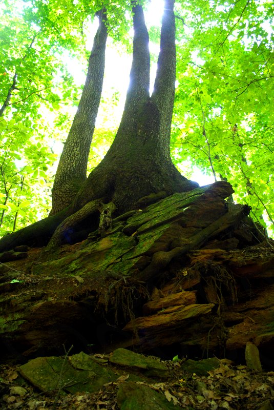
The trail was quite pretty and verdant, traveling along a gully with high rocky sides, for the first part of the trail. Not far along, I met a couple coming the opposite direction. I stopped to talk, because I had spoken with one of the two at the falls. I had asked him if he knew where the trailhead was, and he had not known. He and his traveling companion had found it not much earlier. He mentioned that it looked like this wasn’t the trail, as there was no way that the trail could be following a railbed, and gave an explanation for his position that gave the impression that he had some pertinent knowledge of the subject. He and his traveling companion had decided to head on back, rather than continuing on. I decided that I would keep on going, because even if it was the wrong trail, it was a pleasant hike.
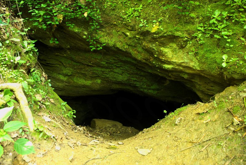
I do not wish to discount this fellow hiker’s knowledge, but not far after I left them, I came upon the spur trail that led up to the Middle Tunnel. A sign and the tunnel itself made it clear that I was on the right trail. There’s not much to the Middle Tunnel, and it is essentially a hole in the side of a hill that has been blocked up not far in, by a bat-friendly gate, designed to deny access to human interlopers. Apparently, this tunnel at one point was done enough to provide passage to horse and rider, but not a train.
I returned to the main trail, and saw a sign that provided a map to the rest of the trail. Now, the previous hike at Parson’s Mountain had provided me with data that maps are useful, even if the trail is well blazed. I had wished then that I had taken a picture of the map to use for later. Therefore, you might think that I would have taken a picture of this map, having learned my lesson. However, for some reason, I did not.
Foreshadowing? Perhaps.
Continuing on mapless, I came upon a couple who weren’t sure which way to turn on the trail, as it seemed to be a T-junction. It was at that moment that I realized my error in not photographing the map, a realization shared by the hiking couple. But, the blazes seemed to indicate that a left turn was the right way to go, and I set off immediately in that direction. The couple followed not long afterward. Luckily, I was right, otherwise I might have led this couple astray.
Since I was stopping to take pictures, the couple moved on ahead of me, and I eventually lost sight of them. But, down the trail, I saw them coming back my way. They smiled and waved, but had, it seemed, decided to go on back, rather than try to make it up to the Saddle Tunnel.
The only other hikers I saw were a group of older folks making their way up an incline. They let me on by, and we briefly chatted before I resumed my pace. I was impressed, because I can only hope that I will be able to take these kinds of hikes when I reach that age.
So, I figured I had gone probably pretty close to 2 and a half miles, but I didn’t see the Saddle Tunnel. I did see, off to the left, what looked like a place where the creek passed through a small hole before going underneath the trail, but it didn’t look anything like a tunnel that would have matched the description of an old railway tunnel. Besides, just ahead, I saw more yellow blazes, so I figured the trail must continue on, and I hadn’t reached the Saddle Tunnel. So, I went on, following the yellow blazes, as I had been trained thus far.
Now, you may be thinking that the hole I had passed had been the Saddle Tunnel and that I was mistakenly following the trail farther than I had intended. That is not the case. However, had I not apparently been futzing with my camera, or studying the left of the trail, I might have seen something off to the right that would have shortened my hike considerably.
But I didn’t look to the right.
And I kept going.
And going.
The trail got considerably steeper, and I started to be a bit concerned for the older hikers who might have some trouble getting up these steep areas. The elevation was followed by a precariously muddy trail that headed down the other side, and I had to seriously watch my step. My concern for the other hikers began to give way to concern for my own safety as I slid multiple times on this stretch of the trail. And then the trail leveled out, and passed an interesting sign that indicated that I was leaving a wilderness area. I tried to remember if that was marked on the map or not.
Feeling foolish, but not wanting to go this far and miss the Saddle Tunnel, I kept going. At every turn, I expected the trail to end at the tunnel, but it never did, but just seemed to stretch on into the distance. Finally, feeling a bit defeated, I gave in and headed back, especially as I had not intended to be gone so long. I passed back into the wilderness area, watched my footing as I re-navigated the muddy part of the trail, crested the ridge, and worked my way back down.
I started to recognize the area as getting close to the unknown hole, and happened to look to my left. And there was the Saddle Tunnel, just off the trail, not 3 or 4 hundred feet from where I had seen the creek pass under the trail. I sat there and took a few pictures of the tunnel (not very successfully, as the lighting wasn’t very good), and then headed back down the trail. I figure I must have gone at least a mile or mile-and-a-half farther than I had intended, and then back, adding between 2 and 3 miles to my trip. By the time I got down to my car, my legs were very ready to stop. I decided not to go to the Stumphouse Tunnel while I was there, but head home.
I did check the map on my way back, and I’m certain that if I had gotten a picture of the map, I would have had a better chance at finding the tunnel on the way up. It might have been nice if there had been a marker or something to show where the tunnel was, but the honest truth is that it wasn’t that easy to miss. So, I got extra exercise; it certainly didn’t hurt me. Much.