Up in Northern Tennessee
After a long hiatus, I took some time off and headed up to Big South Fork National River and Recreation Area to hike up to the Twin Arches.
It has been a very long time since I have been able to post to this blog. It’s been a crazy year and some. Some good things and some challenging things have taken over my life. But, I’ve slowly started getting back out to the mountains of Tennessee and taking pictures. This week, I had taken a couple of days off from work and spent one of those days up in Big South Fork National River and Recreation Area.
Big South Fork is right up near the border of Tennessee and Kentucky, about an hour-and-a-half from Knoxville. Parts of the area are in the Eastern time zone, while others are in the Central time zone, so traveling through the park sends you back and forth in time. I had no particular plans as to where I was going to hike, so I went to the visitor’s center at Bandy Creek. After looking at the large map in the center, I asked the ranger at the desk for a recommendation for a good day hike. The ranger wasn’t the friendliest sort, but he did recommend the Twin Arches Trail, and gave me directions to the trailhead.
The good news is that he provided accurate and helpful directions to a great day hike. What could have been bad news was that he didn’t bother to mention that the road to the trailhead was very rough and might require a truck or other vehicle with plenty of clearance underneath. Fortunately, I was in the truck that day, not the Civic, which would have bottomed out quite handily. Word to the wise, if you want to try this trail.
The trailhead is well-kept, and was blessed with a restroom, for which I was grateful. It had been a long trip up there. There are also picnic benches for those who want to relax before or after the hike. The ranger had let me know that there was a short 1 mile loop to view the arches and then return, or a 4.6-mile loop. I had chosen the latter, as I was wanting to be out for some time. Getting my gear together, I set off to see how this hike went.
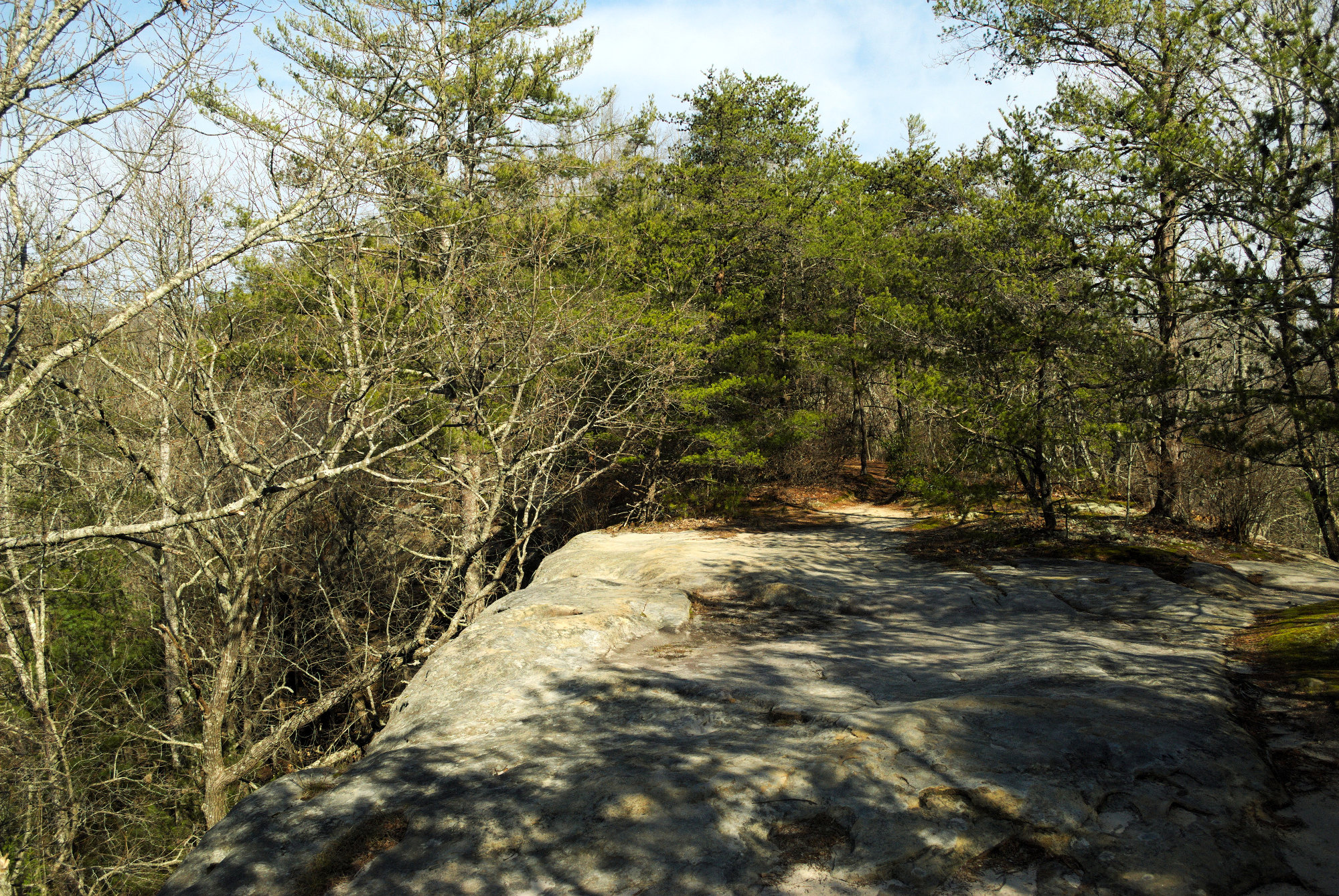
First thing to know about the hike is that there are some very steep steps to get one down to the arches. I had just sent a picture of the view from the top to the family back home when I looked down and saw the path. Don’t get me wrong, they’re very sturdily built stairs, but one may wish to take great care getting down. I got to the bottom without incident and continued on. At one point, the trail opened out onto a bare stone area with views on either side before another set of steep steps. I stopped to take a few pictures and then headed down.
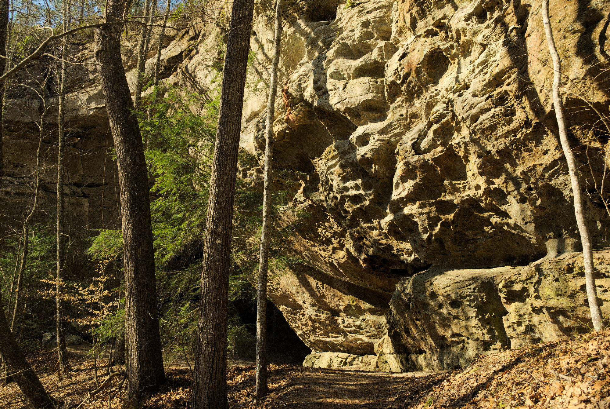
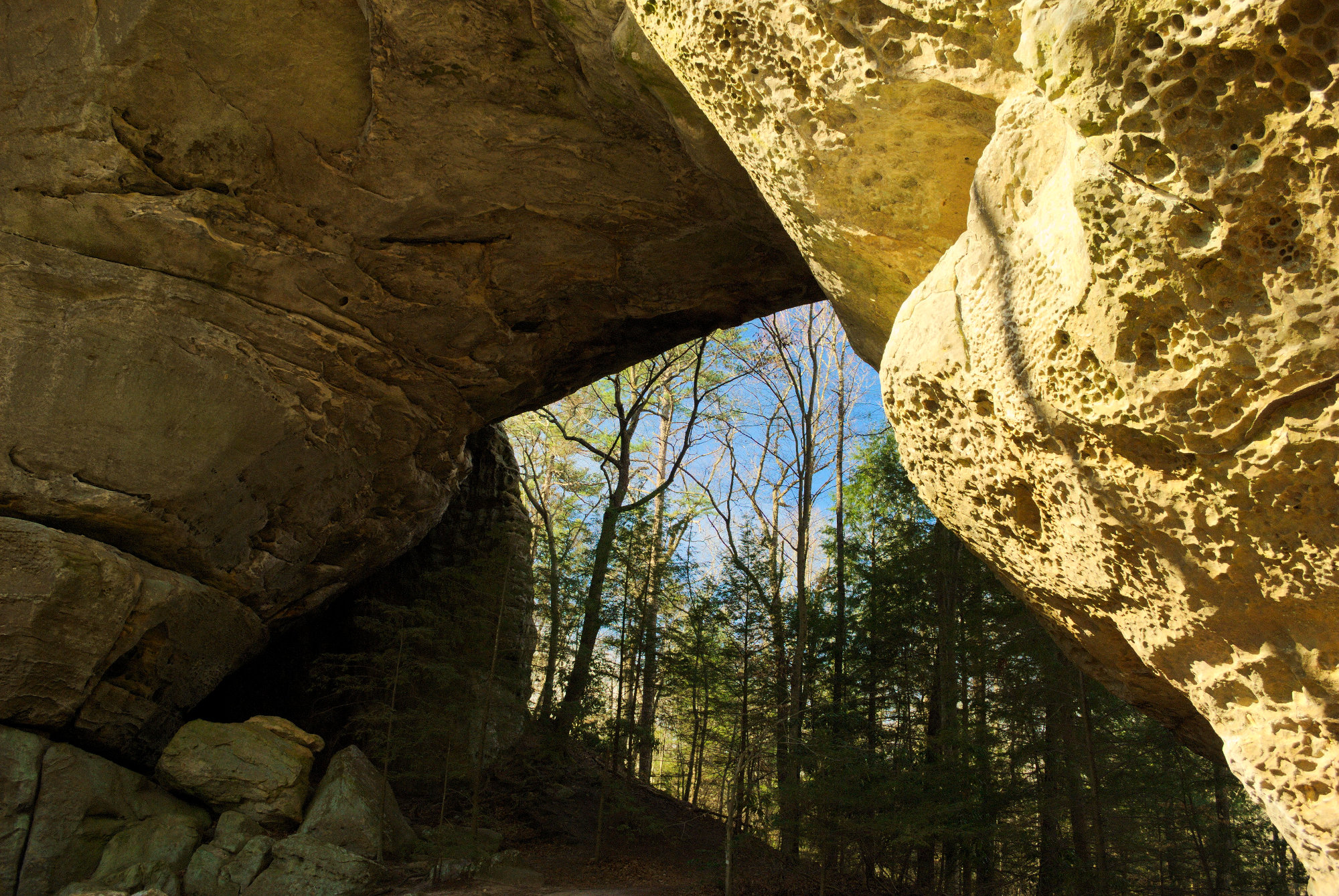
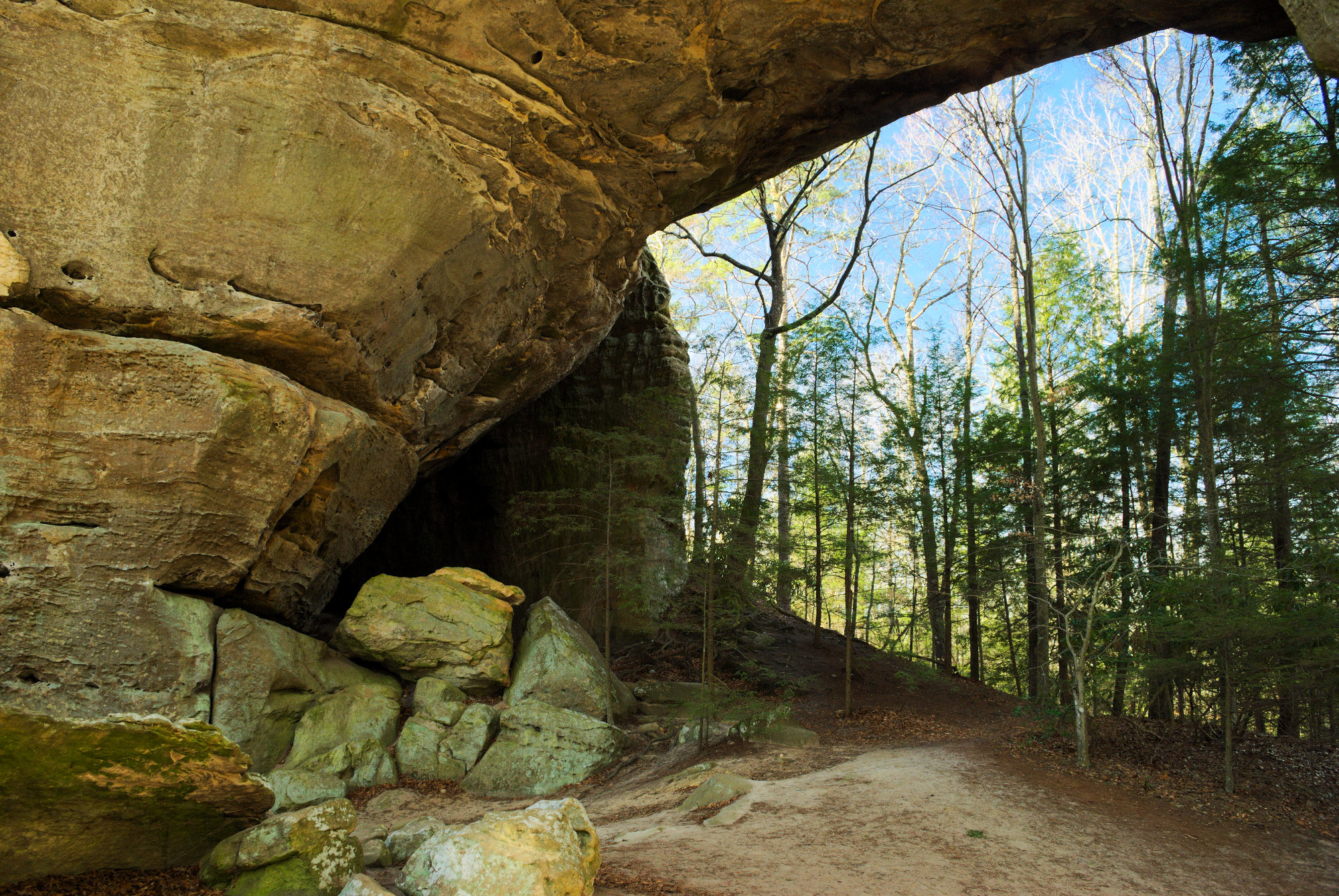
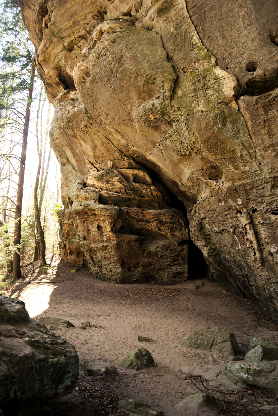
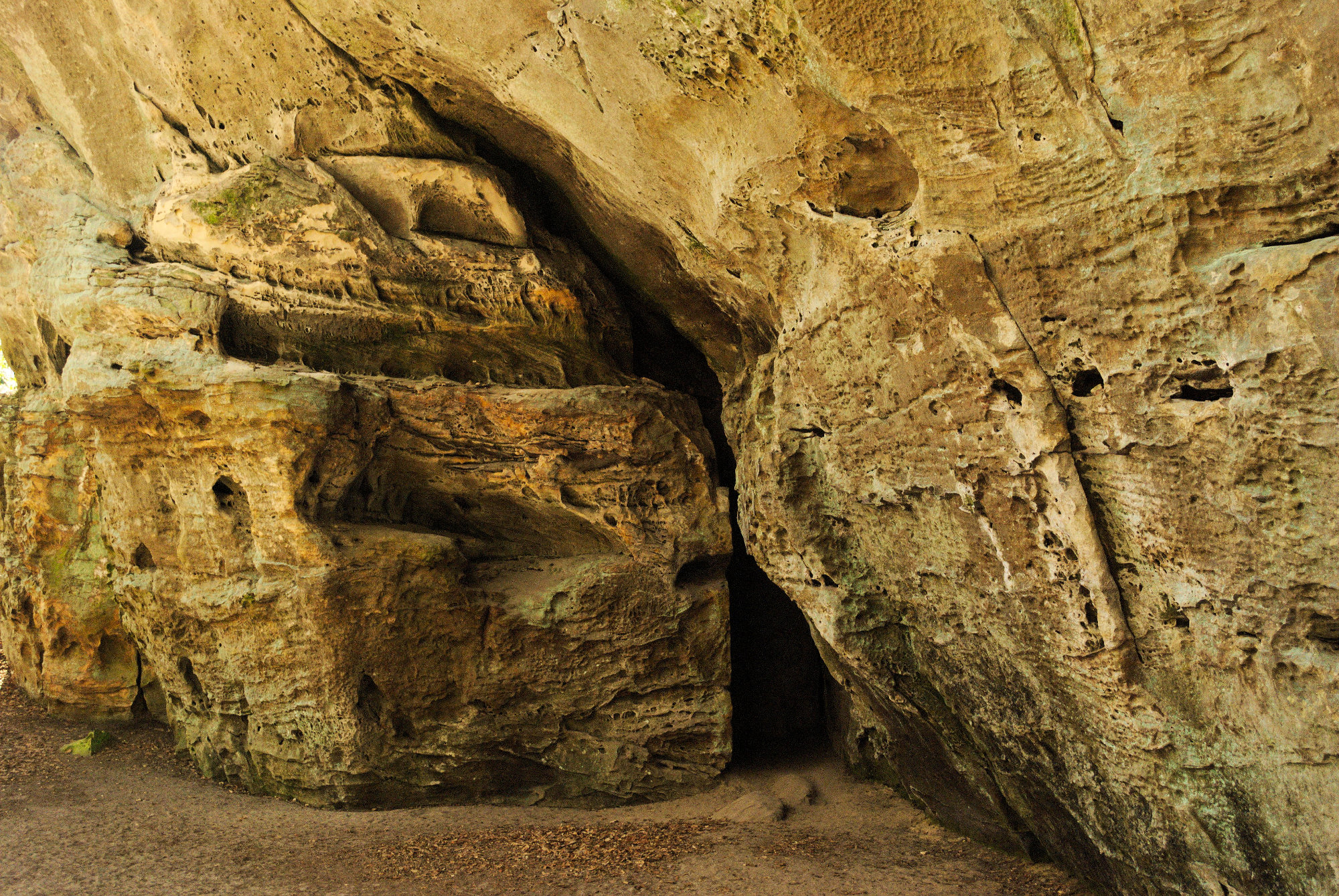
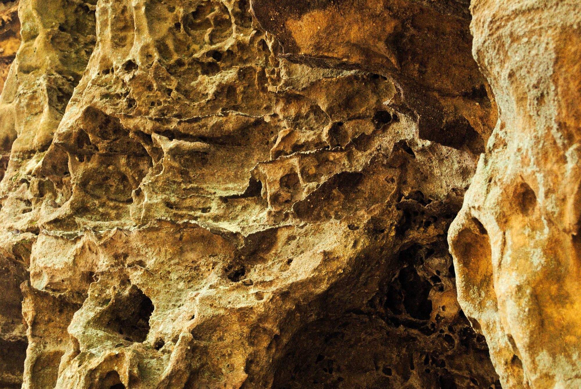
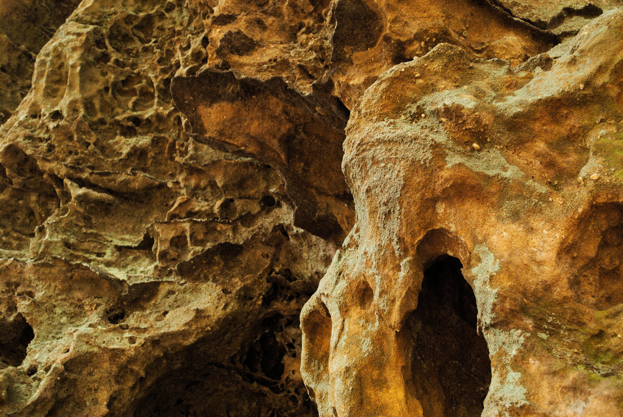
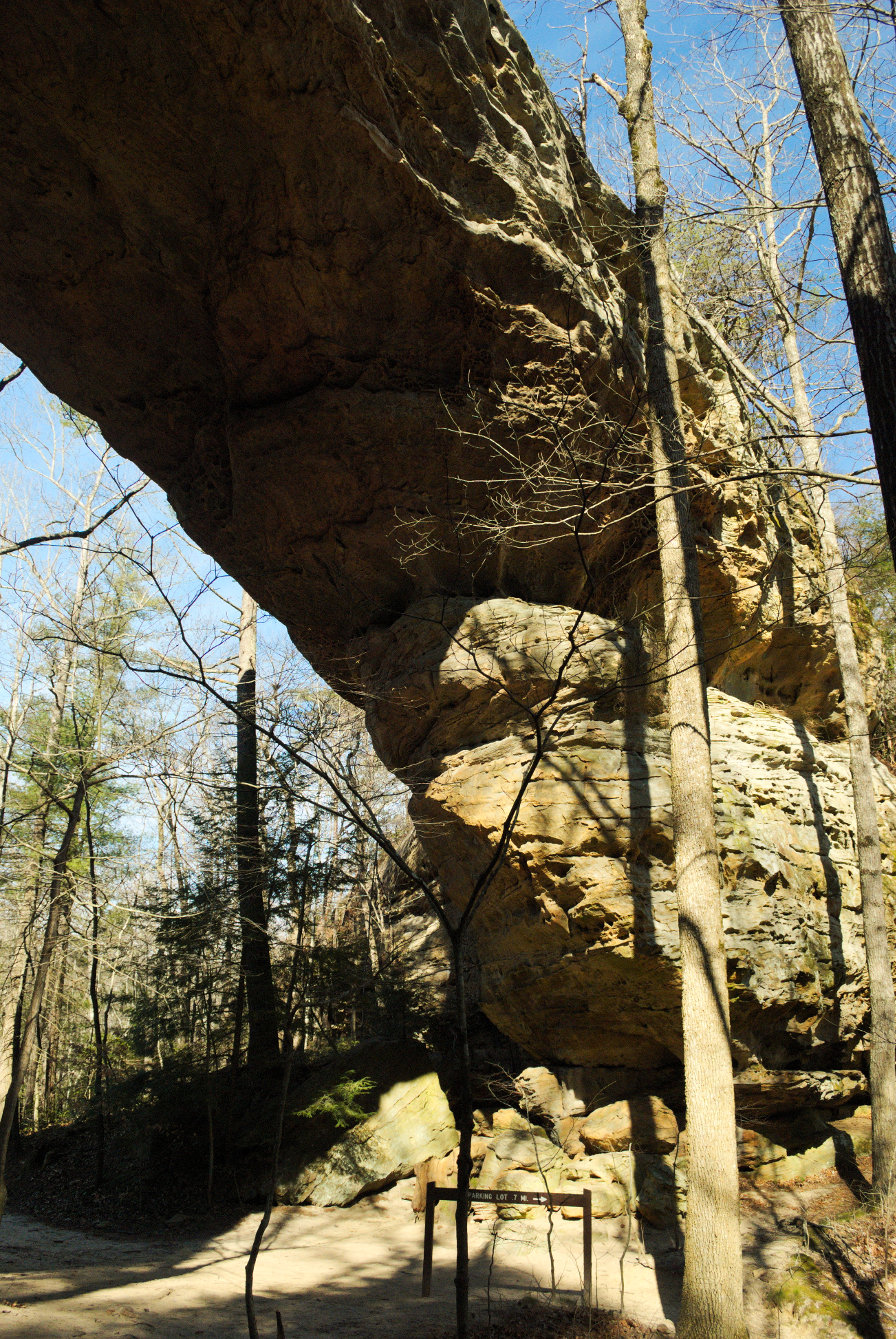
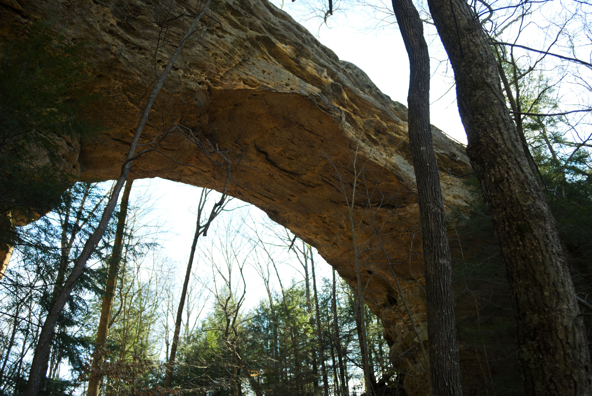
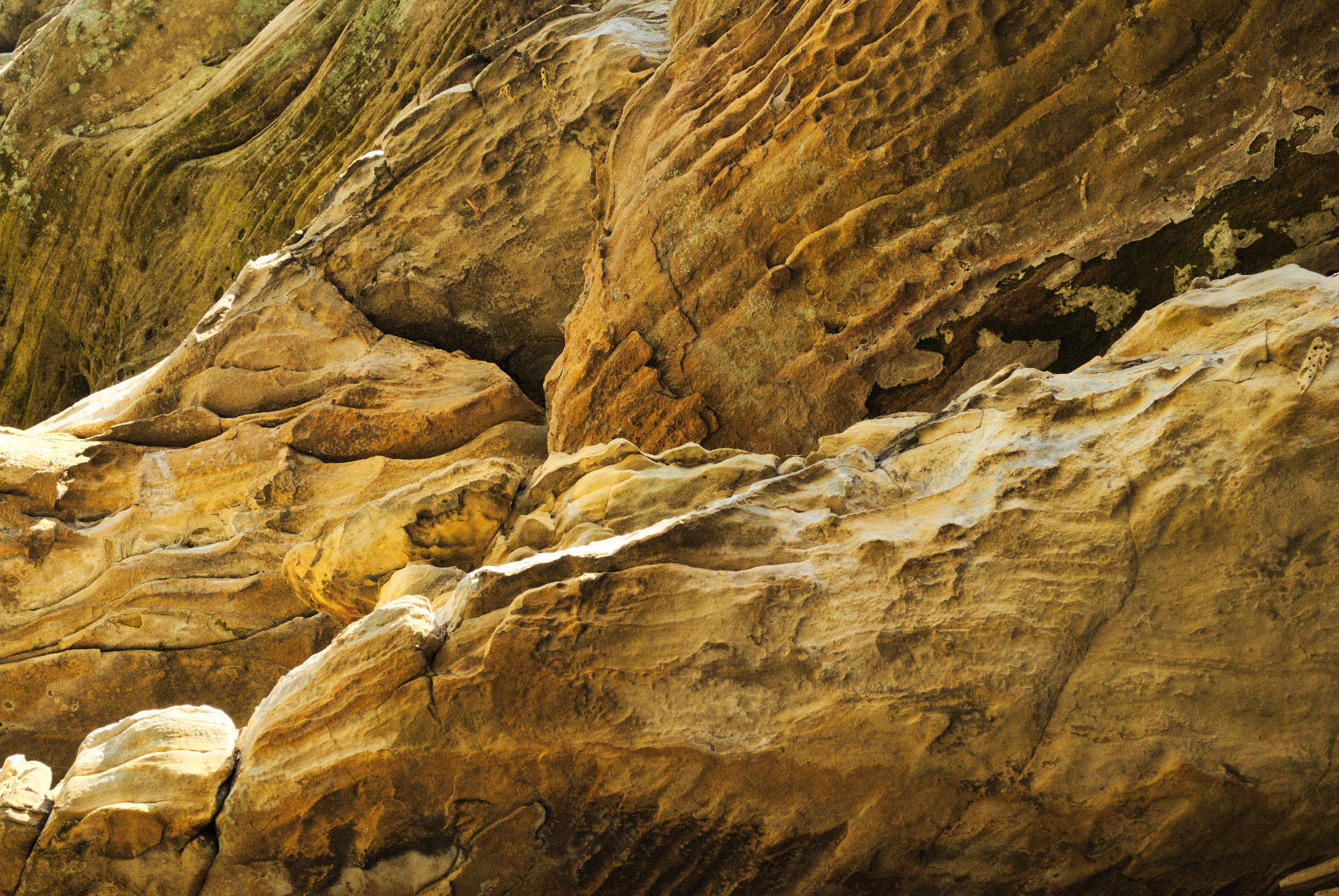
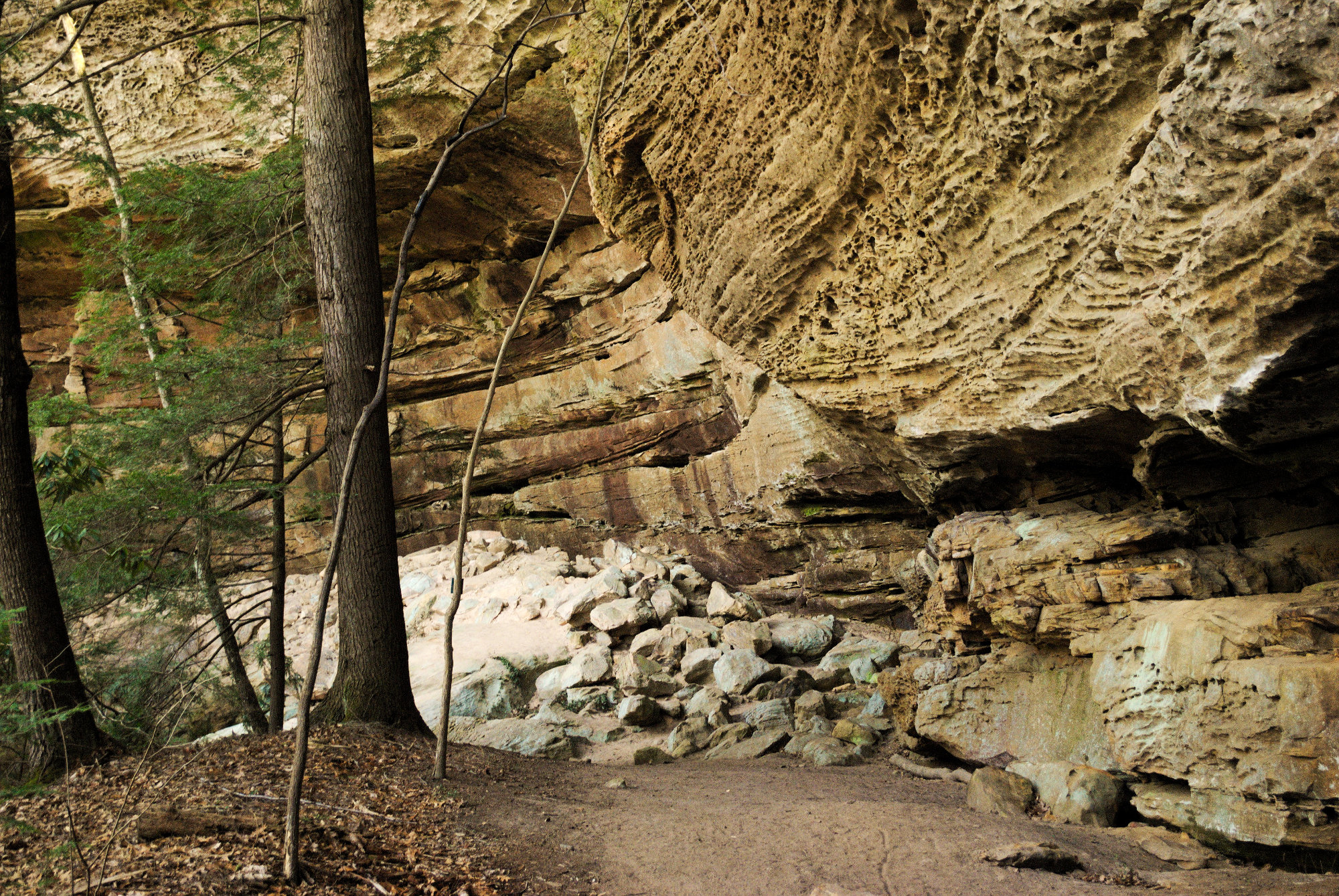
At the bottom of the steps, one can go right to the southern arch, or left to the northern arch. I went to the south and made a hairpin turn to get to the arch. It didn’t take long, and the arch was right ahead. It was impressive, to say the least. This is a great example of erosion wearing away weaker sandstone, leaving this tunnel right through the ridge. I spent some time wandering around the arch, looking closely at the intricate patterns on the walls, where erosion performed its artistry. There were pockmarks, waves, and caves all around the area.
After doing an about face, and heading back the other way, I found the northern arch. As I approached this equally impressive arch, I realized that the open area I had passed over was the top of the northern arch. Probably pretty obvious, but hey, it was my day off, and I let my brain relax, as well. I took some pictures there, as well, and then headed through the arch to start the loop trail.
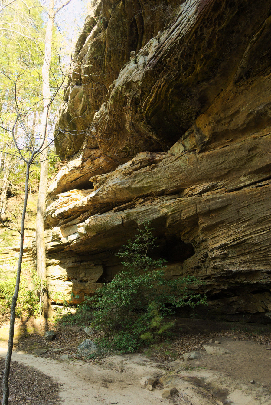
The arches would have been worth the trail in and of themselves, but the trail continued to wind around the ridge, where erosion continued to spread its textural graffiti across the cliffside. I went under massive overhangs and even sat under one to read for a while. A small flow of water poured off of that overhang, and it was amusing to watch how it moved out and back as the wind swirled around and through. Luckily the weather was chilly, but not too cold, and the sky was still pretty blue, so I was able to comfortably rest there and work my way through a good chunk of the book I was working on.
From there, the trail moved away from the ridge and down into more conventional territory, winding through hardwood forests and eventually catching up to what I assume was Bandy Creek. About 2 miles in, I reached “Jake’s Place,” which is an area of campfire areas, surrounded by log benches, in a clearing on the bank of the creek. I stayed there for a while, doing some more reading, until I noted that it was starting to get colder, and the clouds were coming in. It seemed prudent to continue on.
The rest of the trail followed the creek back to the arches, climbing up laddered steps and numerous switchbacks to gain elevation relatively quickly. At one point, I saw what looked like a white sheet across the ridge. Once I got closer, I saw that I was looking through the southern arch, seeing the sky on the other side. I was back to where the loop started. I climbed back up all of those steps, which by that point was an achievement in itself, and then made my way back to the truck. I will certainly return to Big South Fork.